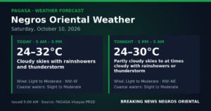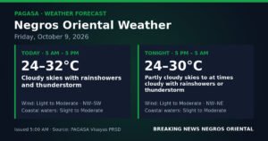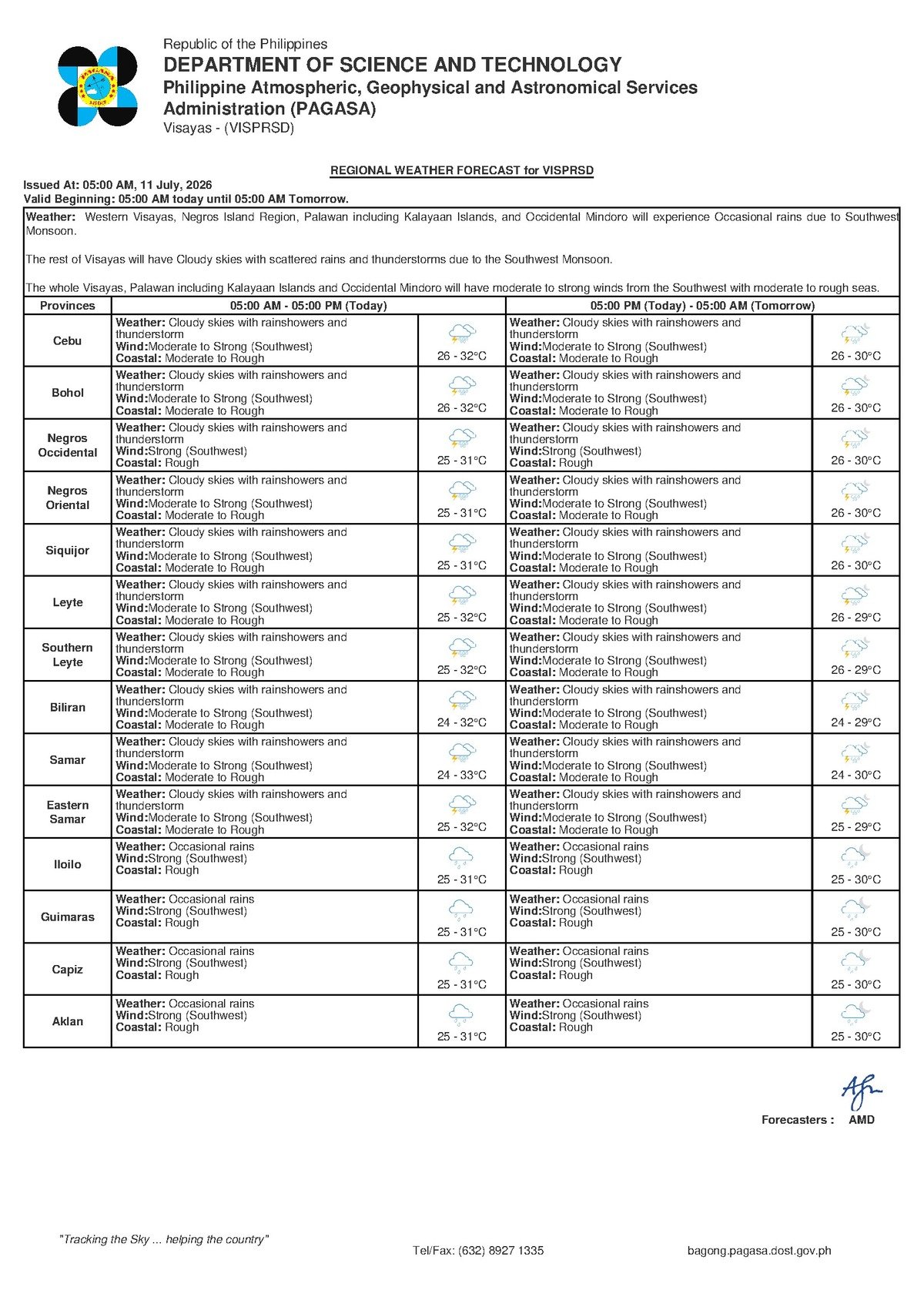
The Visayas woke up to a turbulent Saturday morning as the southwest monsoon continues to pump rain-laden winds across the region, bringing widespread cloudiness, thunderstorms, and hazardous sea conditions. PAGASA’s 5:00 AM forecast issued on July 11, 2026 places the entire Visayas — including Negros Oriental and the island province of Siquijor — under cloudy skies with rainshowers and thunderstorms, with coastal waters rated moderate to rough due to sustained southwest winds blowing at moderate to strong speeds.
The Weather Driver Behind Saturday’s Conditions
While the 5:00 AM PAGASA regional bulletin does not explicitly identify a named weather system in its raw forecast data, the meteorological indicators present — persistent southwest winds, widespread cloudiness, and frequent rainshowers with embedded thunderstorms — are characteristic of active habagat, or southwest monsoon, conditions. PAGASA’s national weather portal, according to its published warning products, is simultaneously showing three active tropical cyclone-related advisories: a Tropical Cyclone Warning for Shipping, a Tropical Cyclone Warning for Agriculture, and a Severe Wind Impact Based Forecast. These concurrent warnings indicate that a broader tropical disturbance is currently influencing weather patterns across the Philippine archipelago, amplifying the monsoon’s effects over Central Visayas.
In practical terms, this is not a passing morning drizzle. The combination of monsoon-fed moisture and tropical cyclone influence means rain is expected on and off throughout the day and into the night, with no guaranteed dry windows. Residents across Negros Oriental — from the coastal lowlands of Dumaguete and Bayawan to the upland communities of Guihulngan and the island of Siquijor — should prepare for a fully unsettled Saturday.
Forecast Conditions Across the Visayas on July 11
Based on the 5:00 AM PAGASA forecast covering the Visayas region, the following conditions are in effect:
- Sky condition: Cloudy with rainshowers and thunderstorms
- Low temperature: 26°C High temperature: 32°C
- Wind direction: Southwest
- Wind speed: Moderate to strong
- Sea state: Moderate to rough
These readings apply broadly to provinces within the Visayas region. Negros Oriental communities stretching from the northern coast down to Bayawan in the south, including inland areas such as Bais and Guihulngan and the adjacent island of Siquijor, fall under this regional forecast coverage.
By the Numbers
- Forecast issued at 5:00 AM on July 11, 2026
- Temperature range: 26°C (low) to 32°C (high)
- 3 active PAGASA warning products in effect nationally: Tropical Cyclone Warning for Shipping, Tropical Cyclone Warning for Agriculture, and Severe Wind Impact Based Forecast
What “Moderate to Rough” Seas Actually Mean
PAGASA’s classification of coastal waters as moderate to rough carries real consequences for anyone who relies on the sea. Wave heights at this classification are high enough to cause sustained vessel movement and loss of stability, particularly on smaller watercraft such as bangka-type boats and single-engine motorized outriggers commonly used by fisherfolk and short-route inter-island commuters.
For passengers using inter-island ferry services departing from Dumaguete Port — whether bound for Siquijor, Tagbilaran in Bohol, or ports in Cebu — the risk of delays or outright sailing cancellations is real. Ferry operators and port authorities are empowered to suspend sailings when sea conditions deteriorate. Passengers are strongly advised to contact their vessel operator or check port announcements before traveling to the terminal.
Reinforcing the maritime concern, PAGASA has an active Tropical Cyclone Warning for Shipping in effect at the national level. According to PAGASA, this advisory is issued when tropical cyclone activity creates conditions that are hazardous to vessels navigating Philippine waters. While the regional bulletin does not specify a wind signal number for Negros Oriental, the shipping warning serves as a clear signal to all mariners — commercial and small-scale alike — to exercise heightened vigilance before any sea departure.
Breaking Down the Three Active PAGASA Warnings
Tropical Cyclone Warning for Shipping
This advisory, currently active as shown on the PAGASA national website, alerts mariners to the potential for deteriorating sea conditions linked to tropical cyclone activity. Fishing boat operators, ferry crew, and cargo vessel captains operating in Philippine waters should coordinate closely with the Philippine Coast Guard and local port offices before setting out. Small vessel operators in Negros Oriental’s fishing communities are especially vulnerable and are advised to stay ashore.
Severe Wind Impact Based Forecast
Unlike standard wind speed forecasts, PAGASA’s Severe Wind Impact Based Forecast translates anticipated wind intensity into expected real-world effects on communities. Its activation today signals that gusts are strong enough to damage lightweight or makeshift structures, disrupt outdoor work and activities, and create hazardous conditions for anyone exposed to the elements. Residents with galvanized iron roofing or unsecured outdoor fixtures should take precautionary action.
Tropical Cyclone Warning for Agriculture
The agricultural warning — also currently active according to PAGASA — is designed to alert the farming sector to weather threats originating from or amplified by tropical systems. Strong winds combined with heavy rainfall can flatten standing crops (a process called lodging), flood low-lying paddies, and disrupt critical agricultural tasks such as harvesting and spraying. Farmers are encouraged to harvest any mature crops that can be salvaged before conditions worsen and to secure equipment and livestock.
Guidance for Key Sectors
Fisherfolk and Small-Boat Operators
The Philippine Coast Guard and local maritime authorities have consistently advised small-vessel operators against going out to sea when coastal conditions are rated moderate to rough. Combined with today’s southwest winds at moderate to strong speeds and the national-level shipping warning from PAGASA, small fishing boat operators and bangka pilots in coastal barangays of Dumaguete, Dauin, Zamboanguita, Bais, and Bayawan should remain on shore. Reduced visibility during thunderstorm bursts compounds the dangers of rough swells and strong currents.
Ferry Passengers
Anyone with a scheduled inter-island trip departing from Dumaguete — particularly sailings to Siquijor, Bohol, or Cebu — should call their ferry operator or check online advisories before leaving for the port. Build extra time into travel plans to allow for potential delays, and carry rain gear regardless of departure status. The Philippine Coast Guard monitors sea conditions continuously and may order vessel operators to hold departures if conditions deteriorate.
Farmers and Agricultural Workers
Field activities such as harvesting, plowing, fertilizer application, and pesticide spraying are not advisable today. Heavy and persistent rain creates waterlogging risks in low-lying fields, while strong gusts can topple young crops and recently transplanted seedlings. In sloped or elevated farm areas, wet soil increases erosion risk. Checking irrigation drainage systems and securing farm equipment should take priority over field operations today.
Students, Families, and Outdoor Events
Parents should prepare children with rain gear for any school or community activity, and monitor announcements from local government units in Dumaguete City, Bayawan, Guihulngan, Bais, and other municipalities regarding class suspensions or event cancellations. Lightning activity during thunderstorm bursts is a serious hazard; during active storm periods, individuals should move indoors and avoid open fields, bodies of water, tall trees, and metal structures.
Outdoor and Construction Workers
Site supervisors in construction, road maintenance, and outdoor industries should assess job-site safety before commencing work this morning. Active thunderstorms and slippery surfaces from sustained rainfall significantly raise the risk of accidents. Worksite protocols should include clear triggers for suspending operations when lightning, heavy rain, or strong gusts are present.
Why This Matters
Three simultaneously active PAGASA warning products — covering shipping, agriculture, and severe wind impacts — signal that this is not routine wet-season rainfall, but a weather event with the potential to disrupt livelihoods, delay essential travel, and cause physical harm to those who are unprepared. The overlap of hazardous sea conditions and tropical cyclone-linked advisories poses direct and immediate risks to fishing communities, inter-island commuters, and farming households across the Visayas. Heeding PAGASA’s advisories and coordinating with the Philippine Coast Guard and local authorities can make the difference between safe and dangerous decisions on a day like this.
Source: Breaking News Negros Oriental (breakingnewsnegrosoriental.com), based on PAGASA’s 5:00 AM regional forecast for the Visayas, July 11, 2026.