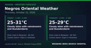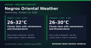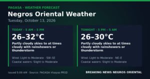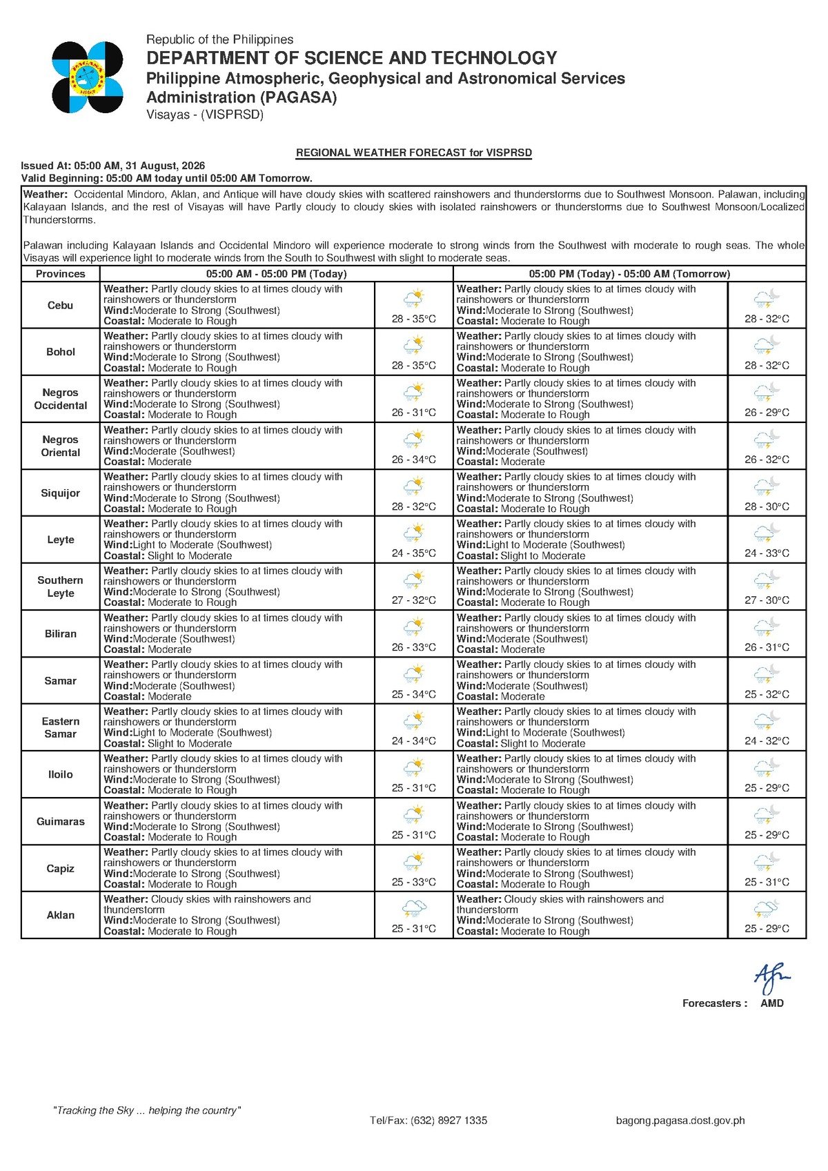
DUMAGUETE CITY, Negros Oriental — August 31, 2026 — The southwest monsoon is making its presence felt across Negros Oriental this Monday, with the Philippine Atmospheric, Geophysical and Astronomical Services Administration (PAGASA) forecasting unsettled skies, bouts of thunderstorms, and moderate to rough seas along the province’s coastlines for the entire day.
The Force Behind Today’s Weather
PAGASA’s 5:00 AM forecast for August 31, 2026, attributes today’s conditions to the habagat, the Filipino term for the southwest monsoon. The habagat is a seasonal wind system that carries warm, moisture-heavy air from the southwest across the Philippine archipelago, generally active from June through September. When the habagat intensifies, it produces persistent cloud cover, intermittent rain, thunderstorms, and choppy coastal waters — particularly for communities along exposed shorelines. Negros Oriental, whose long coastline faces both the Tañon Strait and the Bohol Sea, is especially vulnerable during active habagat episodes, according to PAGASA.
The regional forecast covers the entire Visayas and was officially issued at 5:00 AM on Monday, August 31, 2026.
Today’s Forecast at a Glance
PAGASA’s forecast describes sky conditions as partly cloudy at times turning fully cloudy, with rainshowers and thunderstorms developing throughout the day. Weather will be variable — short sunny intervals may appear, especially in the morning hours, but these should not be taken as a sign that the rest of the day will be clear. Thunderstorms can develop rapidly during habagat season and may bring sudden heavy downpours with little advance warning.
Temperatures across the Visayas are expected to range from a low of 28°C to a high of 35°C. While rainfall provides some cooling relief, periods between showers can still feel oppressively humid, particularly for outdoor workers and those engaged in physical labour.
Southwest winds are classified as moderate to strong across the region, according to PAGASA. These wind speeds are sufficient to generate significant wave action along open stretches of coastline, including areas fronting the Tañon Strait in municipalities such as Bayawan, Bais, and Guihulngan, as well as the sea lanes connecting Negros Oriental with Siquijor and Cebu.
Understanding “Moderate to Rough” Seas
PAGASA classifies today’s coastal water conditions as moderate to rough — a designation that has real and practical implications for anyone travelling by sea or earning a livelihood on the water.
Under PAGASA’s scale, moderate seas refer to wave heights typically between 1.25 and 2.5 metres. At these heights, smaller inter-island vessels and passenger bangkas experience significant rocking motion, and seasickness is a common complaint. Outrigger fishing boats operating in these conditions face genuine risk of swamping or capsizing.
Rough seas, which represent the upper end of today’s forecast range, involve waves that can exceed 2.5 metres. The Philippine Coast Guard advises that small watercraft should remain in port when seas reach this level. Even larger passenger ferries may experience difficult and uncomfortable crossings under rough conditions.
Anyone planning to board a ferry from Dumaguete port — whether with OceanJet, Montenegro Lines, or other operators — should verify sailing schedules directly with the ferry company or the Philippine Coast Guard before proceeding to the terminal. PAGASA and the Philippine Coast Guard both note that voyages may be delayed, rerouted, or cancelled depending on how conditions develop through the day.
Who Is Most Affected
Fisherfolk and Small-Boat Operators
PAGASA’s forecast makes today a high-risk day for anyone operating small vessels on the water. Fisherfolk working out of Dumaguete, Bayawan, Bais, and Guihulngan, as well as those in coastal barangays throughout the province, are advised to stay close to shore or remain docked in port. Thunderstorms associated with the habagat can arrive quickly and bring sudden, dangerous wind gusts that overwhelm outrigger bangkas. Those already at sea should head back to port without delay rather than waiting for conditions to deteriorate further, PAGASA’s guidance states.
Ferry Passengers and Inter-Island Commuters
Travellers intending to cross to Siquijor, Cebu, or other Visayas destinations should contact ferry operators and allow extra time before heading to the pier. Voyage cancellations or delays are possible, particularly during morning and evening departure windows. Passengers who experience motion sickness are advised to take appropriate medication before boarding, should their crossing proceed. Having a backup plan — including alternative travel dates — is recommended given the unsettled conditions.
Farmers and Agricultural Workers
For farmers across Negros Oriental, the southwest monsoon rains bring both benefit and risk. Crops such as sugarcane, rice, and vegetables in active growing stages benefit from consistent rainfall. However, heavy downpours produced by thunderstorms can trigger localised flooding in low-lying farm areas and may damage fragile produce. Farmers should secure harvested crops ahead of showers and avoid remaining in open fields during active lightning activity, which poses a direct physical danger. Those working in interior and upland municipalities such as Guihulngan should remain alert to runoff and soil saturation.
Students, Parents, and Daily Commuters
Thunderstorms can occur at any time during the day, including the afternoon period when school dismissal typically coincides with peak convective activity during habagat season. Parents are advised to equip children with rain gear and to monitor official school communication channels for weather-related announcements. Schools holding outdoor activities or flag ceremonies should have indoor contingency options prepared in advance.
Construction and Outdoor Workers
Workers in construction, road maintenance, and other open-air occupations should be ready to suspend operations during active thunderstorm periods. Lightning is a genuine hazard for those in elevated, open, or metallic work environments. Site supervisors should enforce clear protocols for stopping work at the first sound of thunder or onset of heavy rain. Even during dry intervals, the forecasted high of 35°C combined with physical exertion and high humidity poses a heat stress risk that should be managed through hydration and scheduled rest breaks.
What the Extended Forecast Shows
According to PAGASA’s extended weather outlook, which was issued at 9:00 AM on August 30, 2026, the current weather pattern shows no sign of significant improvement in the near term. The extended forecast for the coming days carries the same broad conditions: moderate to strong southwest winds, moderate to rough coastal waters, and temperatures hovering in the 27°C to 35°C range. Residents and businesses dependent on coastal activities or outdoor work should treat this not as a one-day disruption but as a continuing weather pattern likely to persist through the coming week, PAGASA indicated.
By the Numbers
- Forecast issued: 5:00 AM, August 31, 2026
- Temperature range today: 28°C to 35°C across the Visayas
- Extended outlook low temperature: 27°C
- Moderate seas wave height: approximately 1.25 to 2.5 metres
- Rough seas wave height: waves exceeding 2.5 metres
- Extended outlook issued: 9:00 AM, August 30, 2026
Why This Matters
Negros Oriental’s long coastline and heavy dependence on inter-island ferry services mean that moderate to rough seas directly affect the daily lives of fisherfolk, commuters, and businesses that rely on sea transport between Dumaguete and neighbouring islands. The continuation of active southwest monsoon conditions through the coming days — as indicated by PAGASA’s extended outlook — means these disruptions are not temporary and require sustained preparation rather than a single-day response. With thunderstorms also posing lightning risks to outdoor workers and potential flooding threats to low-lying farms, the combined hazards of today’s forecast call for heightened awareness across multiple sectors of the community.
Source: PAGASA Regional Forecast — Visayas, August 31, 2026; originally reported by breakingnewsnegrosoriental.com