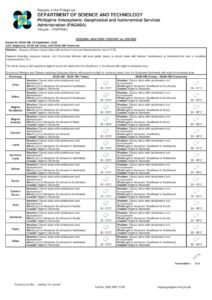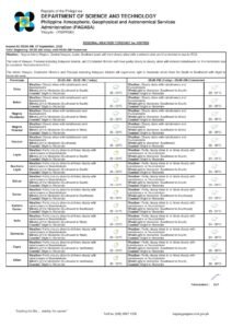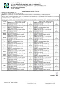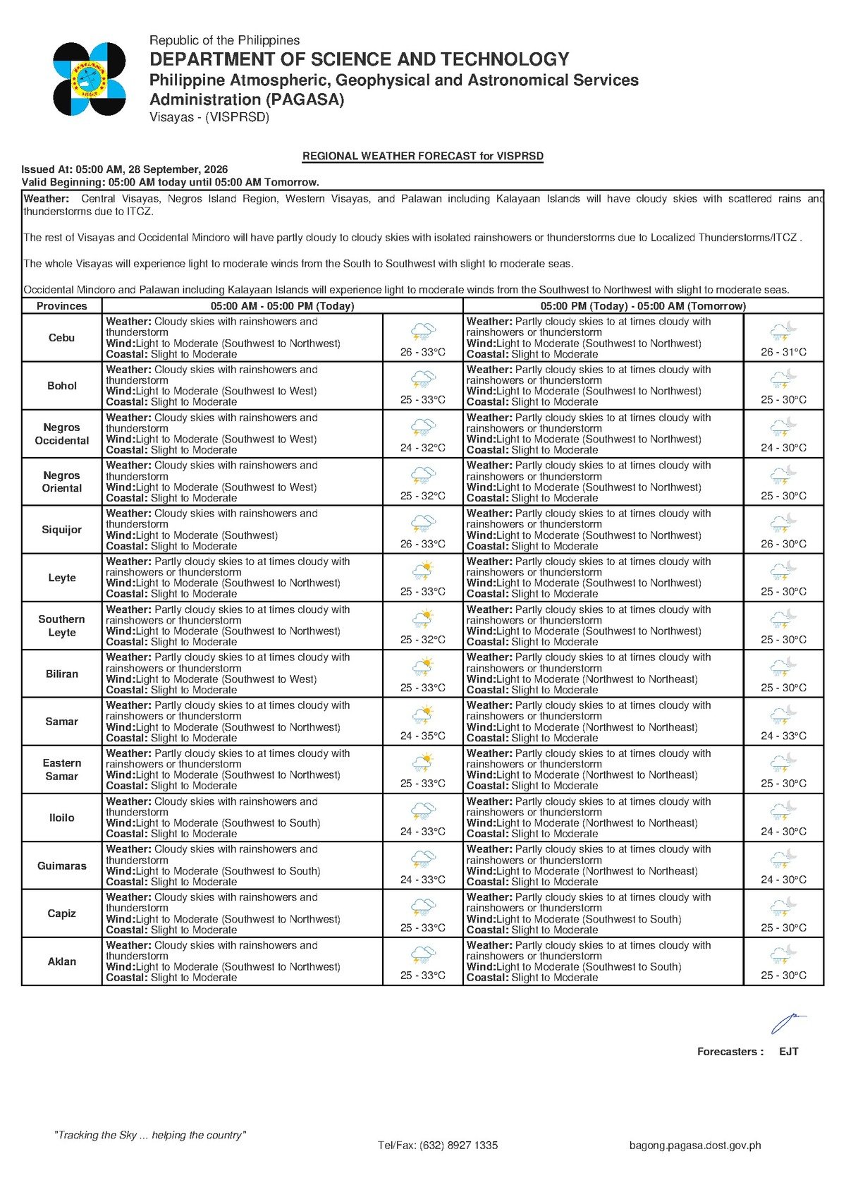
DUMAGUETE CITY, Negros Oriental — The Philippine Atmospheric, Geophysical and Astronomical Services Administration (PAGASA) has issued a wet weather forecast for Tuesday, September 29, 2026, placing Negros Oriental and the entire Visayas region under cloudy skies with expected rainshowers and thunderstorms throughout the day. The advisory, released at 5:00 AM on September 28, 2026, signals an unsettled day ahead for communities stretching from Dumaguete to Guihulngan, Bayawan, Bais, and the island of Siquijor.
The PAGASA Forecast at a Glance
PAGASA’s Visayas regional forecast indicates that Tuesday will see persistent cloud cover accompanied by rainshowers and thunderstorm activity. Temperatures are expected to sit between 26°C on the low end and 33°C at the high, with the warmth effectively moderated by rain and overcast skies throughout the day. According to PAGASA, winds will originate from the southwest to northwest direction at light to moderate speeds, while coastal waters are assessed at a slight to moderate sea state.
A separate extended weather outlook, issued by PAGASA at 9:00 AM on September 28, 2026, adds further context. The Monday baseline showed comparable conditions — temperatures between 26°C and 33°C, southwest-to-southeast winds at light to moderate force, and slight to moderate coastal conditions. For Tuesday itself, the extended forecast shows a marginal upward temperature shift to a range of 27°C to 33°C, with winds continuing from the southwest to northwest at light to moderate intensity. Coastal sea states are expected to remain slight to moderate.
By the Numbers
- Forecast low temperature: 26°C (Monday baseline) / 27°C (Tuesday extended outlook)
- Forecast high temperature: 33°C (both periods)
- Morning forecast issuance time: 5:00 AM, September 28, 2026
- Extended outlook issuance time: 9:00 AM, September 28, 2026
- Coverage date: Tuesday, September 29, 2026
What Is Behind the Unsettled Conditions
PAGASA’s source data for this forecast does not identify a specific weather disturbance — such as a named tropical cyclone, a low-pressure area, or a monsoon system — as the direct cause of Tuesday’s conditions. What the agency’s data does confirm is a southwest-to-northwest wind pattern, which is broadly consistent with seasonal weather behavior in the Visayas during the latter portion of the rainy season. PAGASA advises residents to monitor its official portal at pagasa.dost.gov.ph for updated bulletins, as weather systems can be identified or reclassified as conditions develop.
Breaking Down the Forecast in Practical Terms
A forecast calling for “cloudy skies with rainshowers and thunderstorm” is not a signal for alarm, but it is a clear call to prepare. As PAGASA’s guidance makes plain, rain is not expected to fall continuously throughout the day — however, showers can arrive without much warning, and thunderstorm episodes are capable of bringing sudden, heavy downpours, lightning strikes, and gusty conditions even when prevailing winds are otherwise described as light to moderate.
The “light to moderate” wind designation generally means that conditions on land will be manageable for most people going about their daily routines. At sea, however, the picture is more nuanced. PAGASA’s coastal assessment of “slight to moderate” sea conditions means that larger inter-island vessels can typically operate within normal parameters, while smaller watercraft — particularly outrigger bancas and open fishing boats — face meaningful risk, especially during the gusty phases associated with nearby thunderstorms.
Guidance for Specific Groups
Commuters and Road Users
Motorists and commuters traveling through Dumaguete, Bais, Bayawan, Guihulngan, and other municipalities across Negros Oriental should expect wet road surfaces and reduced visibility during periods of heavy rain. Slower speeds, increased following distances, and avoidance of flood-prone stretches are strongly advised. PAGASA’s thunderstorm forecast also means lightning is a real hazard — residents should avoid sheltering under tall trees or open structures during active electrical storms.
Fisherfolk and Small-Boat Operators
According to PAGASA’s advisory, coastal waters will be slight to moderate — a range that is workable under ordinary circumstances but that can deteriorate quickly when thunderstorms develop. Fisherfolk and small-vessel operators along the Negros Oriental coastline, including those departing from Dumaguete port, Bayawan, and communities along the Tañon Strait, are urged to exercise heightened caution. If thunderstorm activity is observed approaching or overhead, mariners should immediately make for the nearest safe harbor and wait for conditions to stabilize rather than attempting to ride out the weather at sea.
Communities around Siquijor, whose surrounding waters are known to become choppy rapidly under stormy conditions, should take the same precautions even when the broader coastal rating remains slight to moderate. The localized effects of a nearby thunderstorm cell can far exceed the general sea state assessment.
Ferry Passengers and Inter-Island Travelers
Those planning inter-island voyages — including routes connecting Dumaguete to Cebu, Siquijor, and other destinations — should get in touch with their ferry operators before heading to the port. While slight to moderate seas fall within normal operating parameters for larger vessels, ferry companies may impose temporary service suspensions during active thunderstorm periods as a precautionary measure. Passengers should allow extra travel time and monitor official announcements from their respective carriers.
Farmers and Agricultural Workers
Agricultural workers in upland barangays across municipalities such as Valencia, Pamplona, Siaton, and Sta. Catalina should note that while today’s rainfall could provide beneficial moisture to crops, prolonged downpours carry the risk of waterlogging in low-lying fields. PAGASA’s thunderstorm warning also means that open-field work should be suspended during active lightning. Loose equipment, seedling trays, and recently harvested produce that cannot be quickly moved indoors should be secured ahead of anticipated storm periods.
Students, Parents, and Schools
Parents preparing to send children to school on Tuesday are advised to equip them with umbrellas and waterproof bags. Given that PAGASA is forecasting thunderstorm activity, families in flood-prone areas or barangays with difficult road access during heavy rain should monitor announcements from local government units and school administrators regarding possible class suspensions throughout the day.
Outdoor Workers and Event Organizers
Anyone with outdoor activities scheduled for Tuesday — from construction crews to community events and sporting activities — should build contingency plans into their schedules. PAGASA’s forecast makes clear that conditions can shift rapidly from partly overcast to stormy. Where possible, priority outdoor tasks should be completed during early morning hours before the likelihood of afternoon thunderstorm activity increases. Workers and organizers should be ready to pause all outdoor operations as soon as rain or lightning begins.
What the Coming Days May Bring
PAGASA’s extended outlook indicates that the weather pattern affecting the region is not expected to improve dramatically after Tuesday. Temperatures are projected to remain in the 26°C to 33°C range, with light to moderate winds and slight to moderate coastal conditions persisting into the subsequent days. The agency strongly encourages residents not to assume that Tuesday marks the end of the wet spell, and to continue checking official PAGASA bulletins at pagasa.dost.gov.ph for any reclassification of the prevailing weather system or adjustments to the forecast.
Why This Matters
Negros Oriental’s coastal communities, fisherfolk, and agricultural workers are among those most directly exposed to the impacts of sudden thunderstorms and elevated sea states, making timely weather guidance from PAGASA essential for day-to-day safety decisions. The combination of thunderstorm risk, unsettled coastal waters, and wet road conditions across the province underscores the importance of preparedness — particularly for residents dependent on sea transport and open-field livelihoods. Continued monitoring of PAGASA’s official advisories remains the most reliable way for both individuals and local authorities to respond appropriately as conditions evolve.
Source: Breaking News Negros Oriental (breakingnewsnegrosoriental.com), based on PAGASA Visayas regional forecast data.