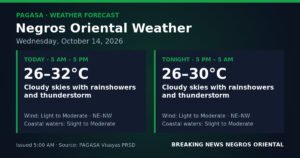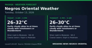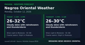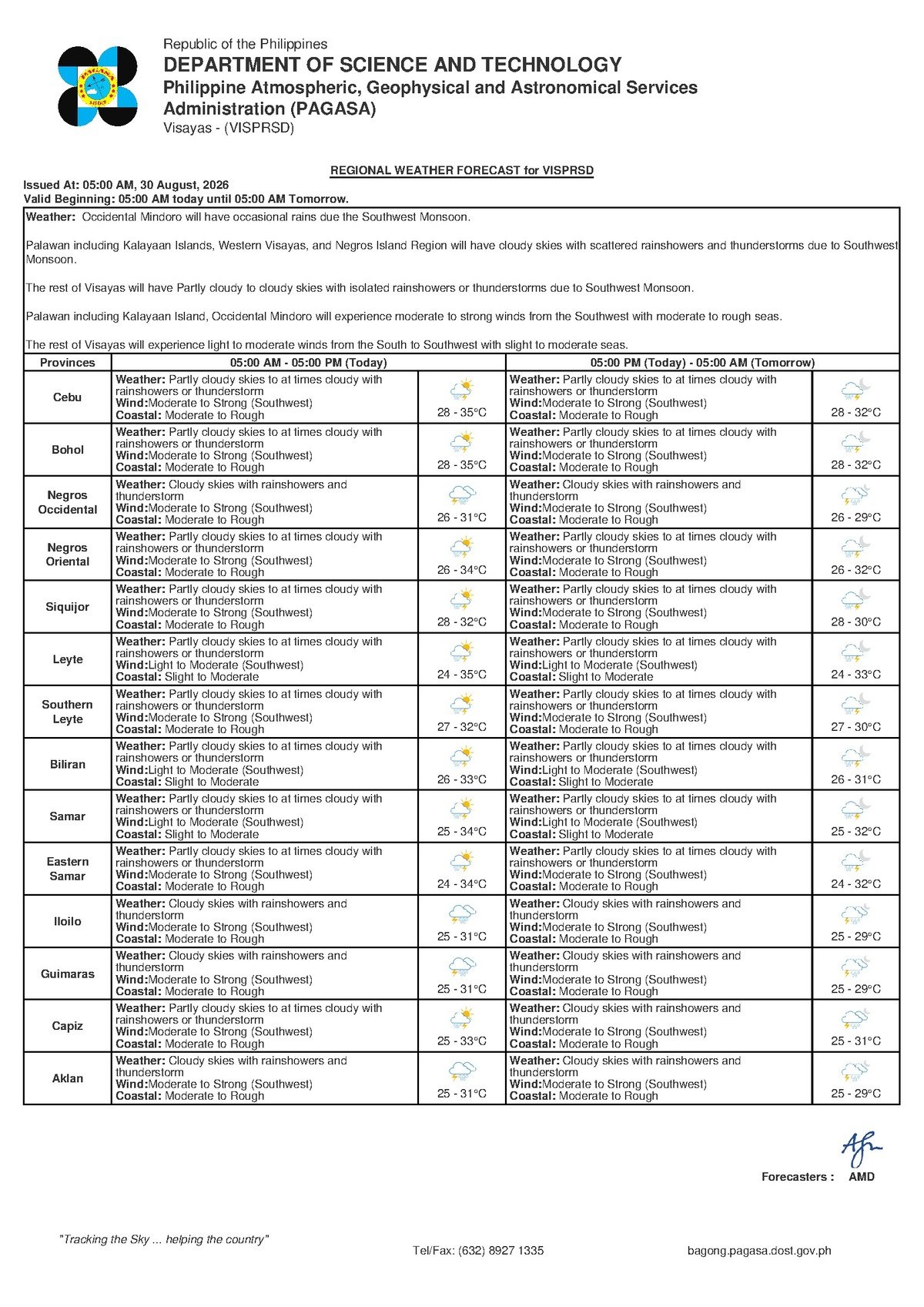
Weather conditions across the Visayas turned hostile on Sunday, August 30, 2026, as the Philippine Atmospheric, Geophysical and Astronomical Services Administration (PAGASA) placed the region under a forecast of rainshowers, thunderstorms, and moderate to rough coastal waters — conditions driven by the fully active southwest monsoon, or habagat. The agency’s Regional Forecast for the Visayas was released at 5:00 AM that morning, covering Negros Oriental, Cebu, Siquijor, and neighboring provinces.
The advisory carries practical consequences for a wide range of people: ferry passengers at Dumaguete port, small banca operators off the coasts of Bayawan and Bais, farmers tending crops in Guihulngan and Manjuyod, and urban residents bracing for another day of on-and-off downpours. The bottom line from PAGASA is unambiguous — exercise extra caution and plan accordingly.
The Force Behind the Weather
PAGASA’s forecast traces Sunday’s unsettled conditions directly to the southwest monsoon, a seasonal wind system that typically holds sway over the Philippines from June through September. During this period, warm, moisture-saturated air sweeps in from the South China Sea and the waters lying west of the archipelago, carrying clouds, rainfall, and gusty winds deep into the Visayas and other central island groups.
The habagat is not an unusual visitor in late August — it returns every year with near-clockwork regularity. But its reliability does not soften its impact on daily life. The monsoon feeds the day’s forecast thunderstorms, churns the coastal waters to moderate-to-rough status, and keeps winds blowing persistently from the southwest at moderate to strong speeds. For communities that depend on the sea or on outdoor livelihoods, this translates into genuine disruption.
Sunday’s Forecast at a Glance
According to PAGASA’s Regional Forecast issued at 5:00 AM on August 30, 2026, the Visayas region — including Negros Oriental, Cebu, Siquijor, and surrounding areas — should anticipate the following conditions throughout the day:
- Sky condition: Partly cloudy to at times cloudy, with rainshowers and thunderstorms
- Temperature: Low of 28°C, high of 35°C
- Wind speed: Moderate to strong
- Wind direction: Southwest
- Coastal waters: Moderate to rough
These are not borderline figures. PAGASA consistently classifies moderate-to-rough coastal conditions as hazardous for small watercraft, and the added presence of thunderstorms — which can produce sudden strong gusts and waterspouts with very little warning — compounds the danger for anyone at sea.
By the Numbers
- Forecast low temperature: 28°C (Sunday, August 30, 2026)
- Forecast high temperature: 35°C (Sunday, August 30, 2026)
- Extended outlook temperature range: 27°C to 33°C (Saturday through Monday)
- PAGASA Regional Forecast issued: 5:00 AM, August 30, 2026
- PAGASA Extended Outlook issued: 9:00 AM, August 29, 2026
- Small watercraft threshold under PAGASA guidance: less than 20 gross tons
No Relief in Sight: The Days Ahead
Those hoping Sunday’s weather is a passing squall will find little comfort in PAGASA’s Extended Weather Outlook, which was issued at 9:00 AM on August 29, 2026. That forecast projects similar conditions persisting from Saturday through at least Monday — temperatures ranging between 27°C and 33°C, moderate to strong southwest winds, and moderate to rough seas continuing along Visayas coastlines.
The extended outlook signals that this is a multi-day monsoon episode, not a single-day weather event. Fisherfolk, farmers, inter-island travelers, and coastal communities should factor these sustained conditions into their plans for the coming days, rather than waiting for an immediate improvement that PAGASA’s data does not yet support.
Understanding “Moderate to Rough” Seas
PAGASA’s classification of coastal waters as moderate to rough carries specific safety implications that are worth spelling out. Moderate sea conditions already elevate wave heights to levels that make travel by small boat uncomfortable and potentially dangerous, especially in exposed open-water stretches. When seas reach rough status, wave sizes increase further, vessel stability is harder to maintain, and the risk of capsizing or swamping rises sharply for low-freeboard craft — the small motorboats and bancas that are the primary fishing vessels along the Negros Oriental coastline.
PAGASA advises that boats of less than 20 gross tons — the category that covers most small fishing vessels — should remain in port whenever coastal conditions are rated at moderate to rough. This advisory applies Sunday to affected waterways including the Tañon Strait separating Negros and Cebu, and the sea lanes between the Negros Oriental coast and Siquijor Island, according to the agency’s forecast.
Guidance for Specific Groups
Inter-Island Ferry Passengers
Sea travelers departing from Dumaguete City, Bais, or Bayawan — whether aboard fast craft or conventional roll-on/roll-off vessels — are strongly advised to verify schedules directly with their shipping lines before heading to port. Moderate to rough conditions can trigger delays, cancellations, or temporary route suspensions, and fast craft are particularly sensitive to sea state. Passengers bound for Siquijor Island, which has no land connections to the mainland, face the greatest exposure to cancellations and should monitor operator announcements throughout the day, the PAGASA advisory implies.
Fisherfolk and Coastal Boat Operators
PAGASA’s guidance for small banca operators is clear: stay ashore when seas are rated moderate to rough. The economic pressure to head out despite the weather is real, particularly for subsistence fisherfolk, but the agency’s warning is firm. The combination of rough coastal conditions and the threat of sudden thunderstorms — which can spawn waterspouts and localized gusts with little advance notice — makes Sunday an especially risky day to be at sea. Fisherfolk along the coasts of Bayawan, Bais, and the northern Negros Oriental shoreline are urged to secure their boats and wait for an improvement in conditions.
Farmers and Agricultural Communities
Farming communities in Guihulngan, La Libertad, Manjuyod, Bais, and other agricultural areas of Negros Oriental face a different but related set of risks. Thunderstorms can concentrate rainfall rapidly, producing localized heavy downpours that threaten flash flooding in low-lying farm plots and cause physical damage to crops and seedlings at vulnerable growth stages. Farmers with harvested crops or drying grain should move their produce under cover before conditions worsen. Anyone working in open fields should treat audible thunder as an immediate signal to seek shelter — lightning during afternoon thunderstorms is a genuine and underappreciated hazard, PAGASA’s forecast context underscores.
Urban Residents, Commuters, and Outdoor Workers
Residents of Dumaguete City and other urban centres across Negros Oriental should anticipate intermittent rain throughout the day, with the heaviest bursts most likely during the afternoon hours when thunderstorm activity typically peaks. Carrying rain gear is advisable. Low-lying streets and barangays that are prone to flash flooding may experience inundation if a thunderstorm stalls over one area. Parents with children in school should check for any weather-related announcements from local government units or the Department of Education. Construction crews, market vendors, and workers near waterways or drainage channels should keep a clear evacuation plan in mind as conditions evolve.
Keeping Up With Changing Conditions
PAGASA issues updated regional forecasts multiple times each day. Given that both the Sunday morning advisory and the extended outlook point to continued unsettled weather through at least early next week, the agency implicitly encourages residents across Negros Oriental, Siquijor, and the wider Visayas to check for the latest forecasts before committing to sea travel, agricultural field work, or extended outdoor activities. Conditions during active monsoon episodes can shift faster than a once-daily check would capture.
Why This Matters
PAGASA’s forecast of moderate-to-rough seas and thunderstorms across the Visayas is not a routine inconvenience — it represents a genuine safety risk for the thousands of fisherfolk, inter-island ferry passengers, and coastal workers whose daily livelihoods depend on navigable waters and predictable weather. The agency’s extended outlook, issued on August 29, 2026, projects these hazardous conditions persisting through at least Monday, meaning disruptions to fishing income, agricultural work, and inter-island transport could stretch across multiple consecutive days. Heeding PAGASA’s advisory on small watercraft restrictions and thunderstorm precautions is the most direct way communities can reduce exposure to preventable harm during this active monsoon period.
Source: Breaking News Negros Oriental (breakingnewsnegrosoriental.com), original reporting based on PAGASA Regional Forecast for the Visayas, August 30, 2026.