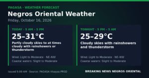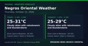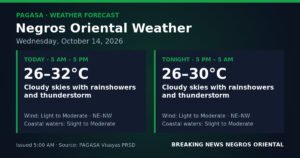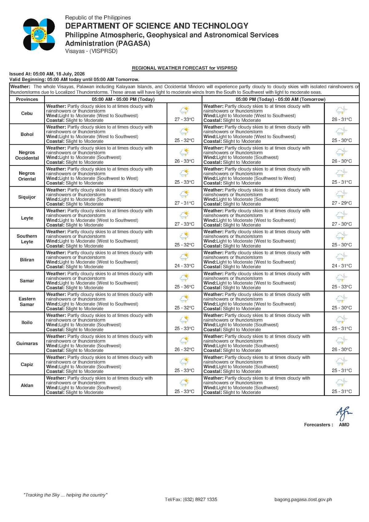
DUMAGUETE CITY, Negros Oriental — A classic wet-season weather pattern is set to dominate the skies over Negros Oriental and the rest of the Visayas this Saturday, July 18, 2026, as moisture-laden southwesterly winds push clouds, rain, and the threat of afternoon thunderstorms across the region. The Philippine Atmospheric, Geophysical and Astronomical Services Administration (PAGASA) released its regional forecast at 5:00 AM Saturday, alerting residents to prepare for a day of shifting skies and intermittent heavy downpours.
Although no tropical cyclone or weather disturbance is currently threatening the area, PAGASA noted that the prevailing atmospheric conditions are more than sufficient to trigger sudden, intense thunderstorms — particularly during the warmer afternoon and early evening hours.
The Weather Driver: Habagat Season in Full Effect
According to PAGASA, winds across the Visayas on Saturday are blowing from the west to southwest at light to moderate speeds. This seasonal wind pattern, commonly referred to as the habagat, is the dominant feature of the Philippine rainy season, which typically runs from June through September each year.
The habagat works by drawing warm, moisture-saturated air inland from surrounding sea surfaces. As that air is forced upward over land — a process that accelerates during the peak afternoon heat — it cools and condenses, forming the thick cloud columns that generate rainshowers and thunderstorms. PAGASA emphasized that while this is not an abnormal or extreme weather event, the speed at which conditions can deteriorate during a habagat afternoon should not be underestimated.
Temperatures on Saturday are forecast to range between a low of 27°C and a high of 33°C. However, the agency’s forecast notes that elevated humidity under habagat conditions means the actual heat index — the “feels like” temperature — could exceed the recorded air temperature. Residents working or exercising outdoors should stay properly hydrated and limit prolonged exposure to midday heat.
Coverage Area: Negros Oriental and the Wider Visayas
The PAGASA Visayas regional forecast applies to the entire region, covering Negros Oriental, Negros Occidental, Cebu, Bohol, Leyte, Samar, and Siquijor. All provinces fall under the same general outlook: partly cloudy to at times cloudy skies, with scattered rainshowers and thunderstorms, and light to moderate westerly to southwesterly winds throughout the day.
Within Negros Oriental, communities from Dumaguete City in the central coast to the northern towns of Bais and Guihulngan, as well as the southern city of Bayawan, can expect alternating sunny spells and cloudy periods during the morning, followed by a higher probability of thunderstorm activity in the afternoon. The neighboring island province of Siquijor, separated from the Negros coast by a narrow strait, falls under the same forecast conditions.
Sunny intervals remain possible in the earlier part of the day, but PAGASA’s forecast makes clear that residents should not count on consistently clear skies at any point during Saturday.
Sea Conditions and Advice for Travelers
PAGASA described coastal waters around the Visayas as slight to moderate for Saturday. According to the agency’s sea state classifications, slight seas carry wave heights of approximately 0.5 to 1.25 meters, while moderate seas can produce swells of 1.25 to 2.5 meters. These figures are not extreme, but they are significant enough to create challenging conditions for small and open watercraft.
Passengers booked on inter-island routes — including services between Dumaguete and Cebu, Dumaguete and Bohol, and crossings to Siquijor — are advised to verify their vessel’s departure status directly with shipping operators such as OceanJet and other fast-craft lines before proceeding to the port. PAGASA noted that real-time conditions at sea can diverge considerably from the general regional forecast, and ferry operators retain the authority to postpone or cancel departures based on what they observe on the water.
Travelers with flexible itineraries are encouraged to book earlier morning crossings, before afternoon winds have had a chance to strengthen. For fisherfolk and small motorized banca operators, the agency’s caution is even more pointed: winds can intensify sharply when a thunderstorm cell forms nearby, and conditions at sea during active lightning and heavy rain are substantially more hazardous than the baseline forecast implies.
Practical Guidance by Activity
Fisherfolk and Coastal Boat Operators
PAGASA’s slight-to-moderate sea forecast means sea travel is not entirely off the table, but small, open fishing boats face real and unpredictable risks. Anyone heading out should monitor the sky closely throughout the day. A rapidly darkening horizon or the sound of distant thunder are signals to return to shore without delay — waiting out a developing storm at sea is not a safe option.
Farmers and Outdoor Agricultural Workers
Rain accompanying Saturday’s thunderstorms may benefit crops requiring moisture, but low-lying farm areas near rivers and drainage channels should be watched carefully for sudden water-level rises. PAGASA advises against working in open fields during active lightning. Harvested produce, equipment, and stored materials should be secured and sheltered ahead of any expected downpour.
Commuters, Motorists, and Daily Travelers
Those traveling in and around Dumaguete City or on provincial roads connecting Negros Oriental municipalities should carry rain gear and allow extra time for their journeys. Mountain and highland routes — including roads toward Valencia and upland barangays — are prone to becoming slippery and susceptible to minor slope failures during intense rainfall. Drivers should reduce speed on wet roads and avoid crossing flooded sections under any circumstances.
Students, Parents, and School Communities
PAGASA’s forecast alone does not trigger school suspension announcements — those decisions are made by local government officials based on actual ground conditions. That said, parents should prepare for the likelihood of rain and possible thunderstorm activity during afternoon school dismissal hours, when the forecast pattern suggests storm development is most probable.
Outdoor Events and Construction Activity
Event organizers and construction site supervisors should build contingency plans for rain into Saturday’s schedule. Morning hours offer the most workable window for outdoor activities, given that thunderstorm probability increases significantly through the afternoon. Having an indoor or covered backup plan ready before noon is strongly recommended.
The Extended Outlook: Saturday Through Sunday
In its extended weather discussion issued at 9:00 AM on Thursday, July 17, 2026, PAGASA indicated that broadly similar conditions are expected to continue into Sunday. Saturday’s temperature range of 27°C to 33°C gives way on Sunday to a slightly cooler range of 26°C to 32°C, with light to moderate southwest winds and slight to moderate coastal sea conditions persisting across the Visayas for both days.
The agency’s outlook confirms there is no significant shift in the weather pattern anticipated over the 48-hour period. Residents of Negros Oriental and the broader Visayas should continue treating both Saturday and Sunday as typical wet-season days: be ready for afternoon rain and thunderstorms, and always verify sea and coastal conditions before undertaking inter-island or offshore travel.
PAGASA’s key practical recommendation remains consistent: carry rain gear at all times, and consult your ferry operator or the nearest PAGASA weather station before departing for any sea voyage — particularly in the afternoon when storm activity is at its most likely.
By the Numbers
- 27°C — forecast low temperature for Saturday, July 18, 2026
- 33°C — forecast high temperature for Saturday
- 26°C to 32°C — forecast temperature range for Sunday, July 19, 2026
- 0.5 to 1.25 meters — wave height range for “slight” coastal sea conditions
- 1.25 to 2.5 meters — wave height range for “moderate” coastal sea conditions
- 5:00 AM Saturday — time PAGASA issued the regional forecast
- 9:00 AM, July 17, 2026 — time PAGASA issued the extended weekend outlook
Why This Matters
The PAGASA forecast signals a full day of rain and thunderstorm risk across Negros Oriental and the Visayas — conditions that directly affect the safety of fisherfolk, inter-island ferry passengers, agricultural workers, and daily commuters. The slight-to-moderate sea state warning is especially consequential for the province’s coastal communities, where small-boat livelihoods depend on timely and accurate weather information. With the habagat pattern expected to persist through Sunday, residents face at least two consecutive days of rapidly changeable afternoon weather requiring consistent preparedness.
Source: Breaking News Negros Oriental (breakingnewsnegrosoriental.com) / PAGASA Visayas Regional Forecast, July 18, 2026