DUMAGUETE CITY, Negros Oriental — September 4, 2026. The southwest monsoon is asserting itself over the Visayas this Friday, bringing a combination of rainshowers, thunderstorms, and choppy coastal seas that will affect ferry passengers, fishing communities, farmers, and anyone with outdoor plans across Negros Oriental and the broader Visayas region.
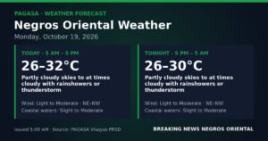
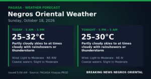
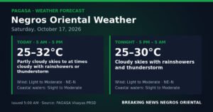
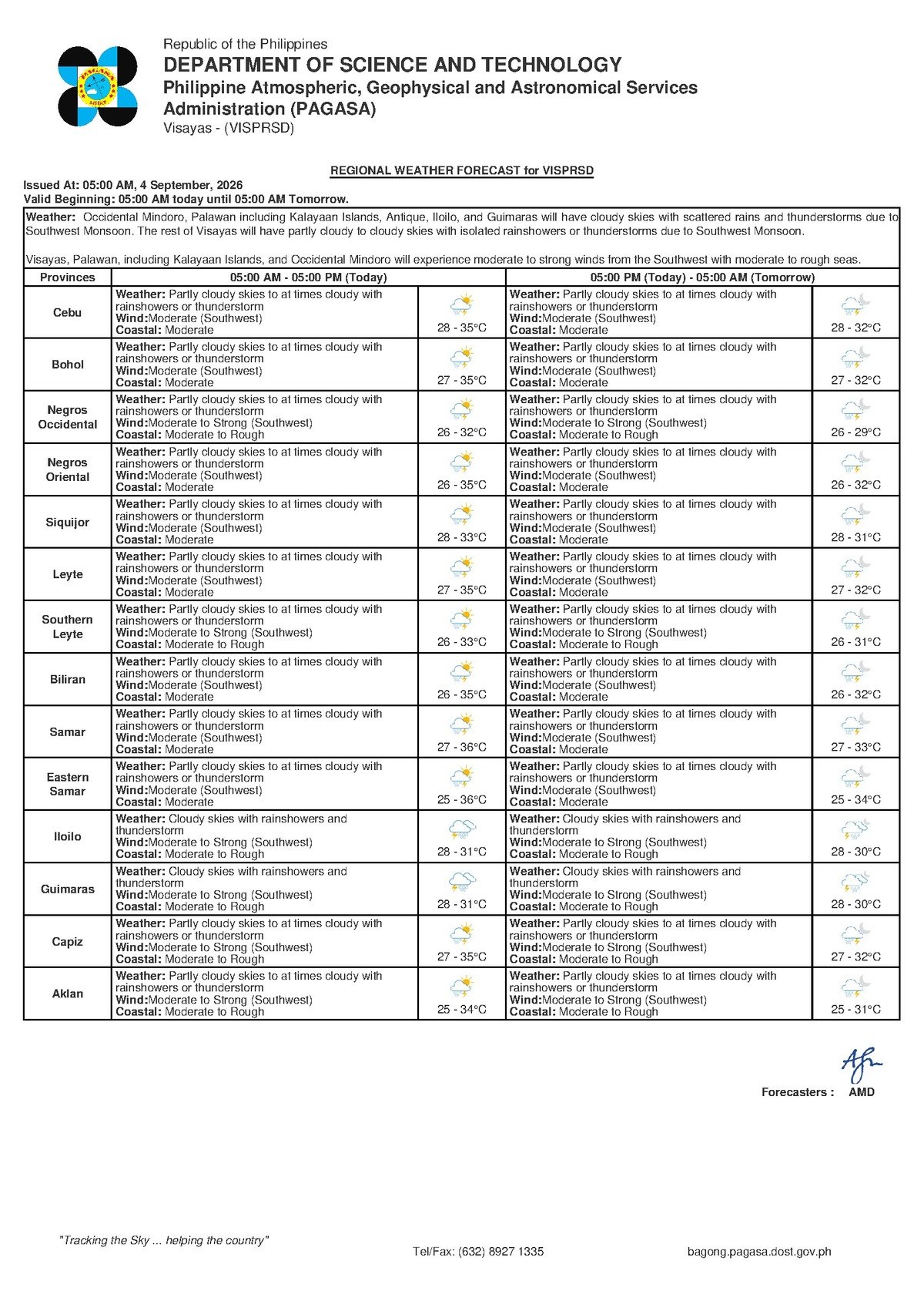
The Philippine Atmospheric, Geophysical and Astronomical Services Administration (PAGASA) released its Visayas regional weather forecast at 5:00 AM on September 4, 2026, projecting partly cloudy to at times cloudy skies with intermittent rainshowers and thunderstorms. PAGASA noted that winds are blowing from the southwest, coastal seas are at moderate levels, and the prevailing wet pattern is not expected to let up through the coming weekend.
By the Numbers
- Forecast low temperature for Friday: 28°C
- Forecast high temperature for Friday: 35°C
- Saturday forecast low: 27°C, high: 34°C
- Sunday forecast: same temperature range as Saturday — 27°C to 34°C
- PAGASA extended outlook issued: 9:00 AM, September 3, 2026
- Initial daily forecast issued: 5:00 AM, September 4, 2026
The Weather Driver: Southwest Monsoon
According to PAGASA’s forecast data, the primary weather driver today is the southwest monsoon, known locally as habagat. This seasonal wind system dominates the Philippine weather landscape from June through September, pushing warm, moisture-heavy air inland from the surrounding sea. When habagat conditions are active over the Visayas, cloud development accelerates through the day, morning sunshine can quickly give way to afternoon downpours, and thunderstorms become a near-daily possibility. The Visayas sits directly in the path of this seasonal airflow, making unpredictable, on-and-off rain the norm for provinces like Negros Oriental during these months.
PAGASA’s data indicates that this pattern will not shift significantly in the short term. Both Saturday and Sunday carry forecasts for similar weather — cloudy skies, rain, and moderate coastal conditions — meaning Friday’s rain is not an isolated event but part of a sustained wet stretch.
Temperature and Sky Conditions Through the Day
Friday temperatures in Negros Oriental are expected to range from a morning low of 28°C to an afternoon high of 35°C, according to PAGASA. The combination of humidity and warmth in the early hours may make the morning feel oppressive before cloud cover and rainfall bring some temperature relief in the afternoon. Residents should not be lulled by any clearing skies in the morning — PAGASA’s forecast makes clear that conditions under habagat influence can shift rapidly, with thunderstorms most likely to develop during the late afternoon and early evening when heat and atmospheric moisture peak.
For Saturday and Sunday, PAGASA’s extended outlook — issued at 9:00 AM on September 3, 2026 — projects slightly cooler conditions, with temperatures dipping a degree on both ends: a low of 27°C and a high of 34°C. Moderate southwest winds and moderate coastal seas are forecast to persist across both days, offering little relief for those hoping for a dry weekend.
Coastal Sea Conditions: What “Moderate” Means in Practice
PAGASA has rated coastal sea conditions as moderate for Friday. This classification indicates seas that are neither calm nor dangerously rough — but noticeably choppy, with wave heights and swells that can make sea travel uncomfortable and, for smaller watercraft, genuinely risky.
For passengers on larger inter-island ferries — including vessels operated by OceanJet and roll-on/roll-off ships serving the Dumaguete–Siquijor, Dumaguete–Cebu, and Dumaguete–Bohol routes — moderate conditions typically translate to a rougher-than-usual crossing. Travellers prone to motion sickness should take appropriate precautions before boarding. PAGASA’s data also underscores that thunder and shifting winds can alter sea conditions quickly, so passengers should confirm trip schedules with their ferry operator and factor in the possibility of delays or rerouting at the discretion of the Philippine Coast Guard.
For small bancas and motorised outriggers used by fisherfolk in coastal barangays around Tanjay, Amlan, Sibulan, and along the Siquijor coastline, PAGASA’s moderate sea rating carries more weight. Small vessels are significantly more vulnerable to swells and sudden squalls. Fisherfolk should consult the latest PAGASA advisories before departure and make it a priority to return to port before afternoon thunderstorms develop.
Guidance by Sector
Fishing Communities and Small-Boat Operators
With moderate seas and a real probability of afternoon thunderstorms, PAGASA’s forecast justifies extra caution for small-boat operators along the Negros Oriental coastline — from Basay in the south to Bindoy in the north, and across to Siquijor. Thunderstorms can intensify rapidly, generating sudden strong gusts dangerous to small watercraft. If sea trips are necessary, fisherfolk are advised to depart early and return to port well before midday.
Inter-Island Ferry Passengers
Anyone planning sea travel out of Dumaguete — whether to Siquijor, Cebu, or Bohol — should check directly with their ferry operator for any schedule changes before proceeding to the port. Moderate seas are generally manageable for large vessels, but thunderstorm development and shifting habagat winds can escalate conditions with little warning. Passengers should bring rain gear and budget extra time for possible port delays.
Farmers in Upland and Lowland Areas
For agricultural communities in upland municipalities such as Canlaon, La Libertad, and Santa Catalina, the forecast presents mixed implications. Rainshowers brought by the southwest monsoon provide soil moisture that many crops benefit from during the growing season. However, stronger thunderstorms can bring gusty winds and localised flooding in low-lying farm plots. Farmers are advised to secure loose equipment and materials, ensure field drainage is unobstructed, and avoid working in open, exposed areas during the afternoon lightning-risk window.
Students, Parents, and Daily Commuters
Afternoon dismissal times are likely to coincide with the highest probability of thunderstorm activity on Friday, according to PAGASA’s forecast pattern. Students and parents should pack umbrellas or rain jackets and plan for wet conditions on the commute home. School administrators in flood-prone areas are encouraged to monitor real-time local conditions and act on any PAGASA warnings issued during the school day.
Outdoor Workers and Event Organisers
Construction crews, market vendors, and organisers of outdoor events in Dumaguete and surrounding municipalities should plan around the likelihood of afternoon downpours. PAGASA’s habagat forecast means a deceptively clear morning sky offers no guarantee of dry afternoon conditions. Contingency arrangements — covered staging, waterproof storage, and early scheduling — are strongly advisable for any outdoor activity on Friday.
Weekend Outlook
PAGASA’s extended forecast makes clear that the wet pattern will carry through Saturday and Sunday. Temperatures will ease slightly to a range of 27°C to 34°C on both days, but coastal seas will remain at moderate levels and southwest winds will continue to prevail. Residents planning weekend outings to destinations such as Apo Island, the Twin Lakes of Balinsasayao and Danao, or any outdoor recreation area in the province should build flexibility into their itineraries and check the latest PAGASA updates before leaving home.
The agency’s forecast underlines a straightforward message: the habagat is active, the rain is not going away soon, and preparation — not optimism — is the sensible response for anyone moving through Negros Oriental this week.
Why This Matters
PAGASA’s forecast of sustained rainshowers, thunderstorms, and moderate coastal seas through the weekend directly affects the daily safety and livelihoods of fishing communities, ferry-dependent travellers, and agricultural workers across Negros Oriental. The persistence of habagat conditions means there is no short-term weather relief on the horizon, making preparedness especially important for vulnerable sectors. Awareness of the forecast — including the elevated afternoon thunderstorm risk — can help residents make informed decisions that reduce risk to life and property.
Source: breakingnewsnegrosoriental.com / PAGASA Visayas Regional Forecast, September 4, 2026