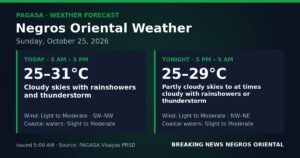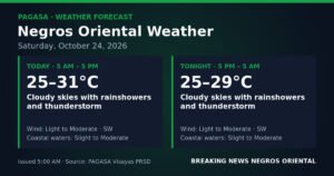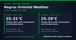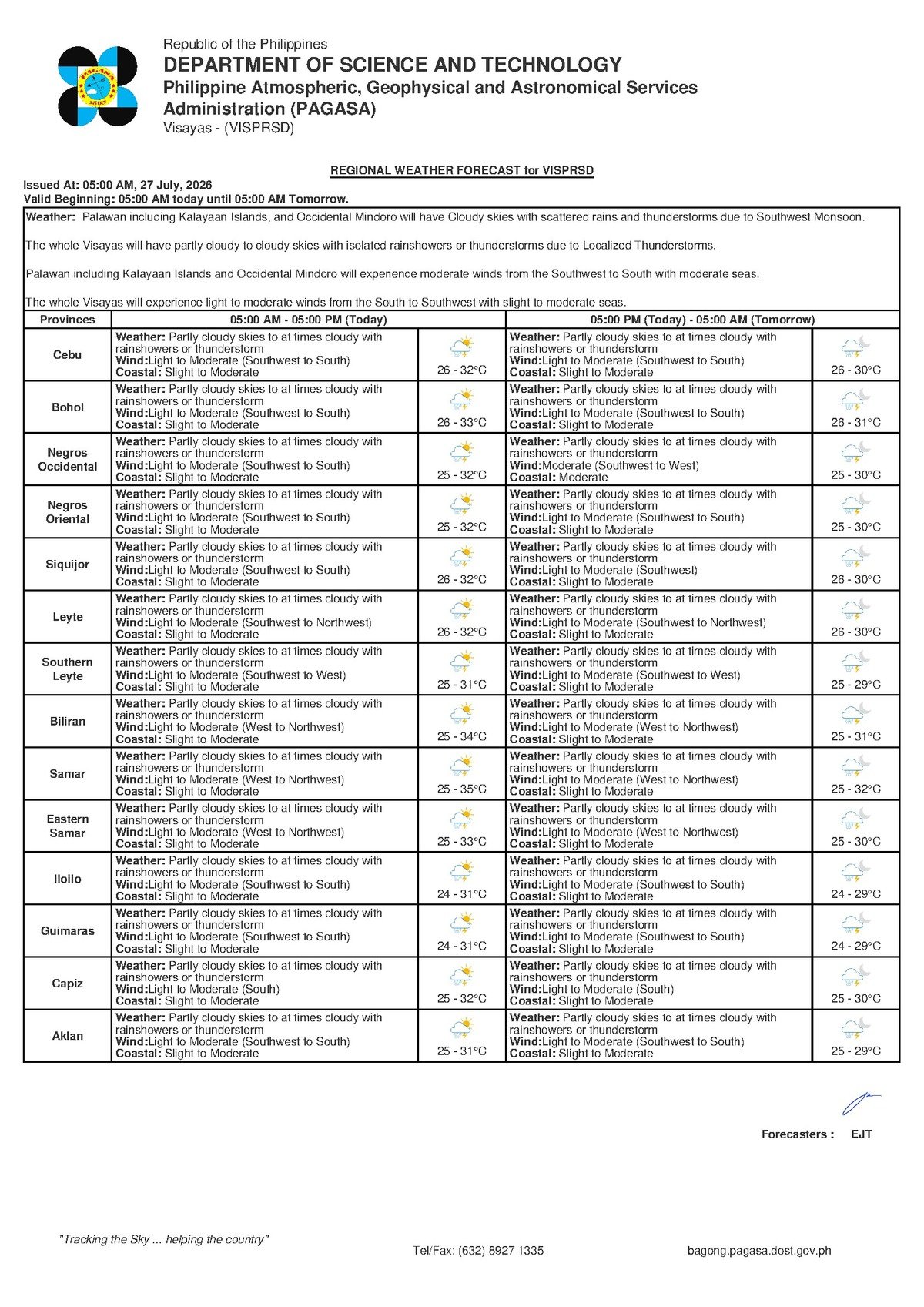
DUMAGUETE CITY, Negros Oriental — July 27, 2026. The Philippine Atmospheric, Geophysical and Astronomical Services Administration (PAGASA) has placed Negros Oriental and the wider Visayas region under a forecast of rainshowers and possible thunderstorms for this Monday, with the southwest monsoon — locally known as the habagat — identified as the primary weather driver. The agency released its forecast at 5:00 AM on July 27, 2026, covering Dumaguete, Bayawan, Bais, Guihulngan, and the island of Siquijor, among other Visayas areas.
While the conditions are not classified as extreme or dangerous, PAGASA’s advisory points to an unsettled day that will require added vigilance from coastal workers, commuters, farmers, and anyone with outdoor activities planned.
The Monsoon Behind the Rain
According to PAGASA, winds across the Visayas are blowing from the southwest to south direction — the classic signature of the habagat, or southwest monsoon. This seasonal wind system typically holds sway over Philippine weather from June through September each year, drawing warm and moisture-heavy air from the surrounding seas onto the country’s land areas. The result, as PAGASA forecasts for today, is a consistent build-up of clouds, periodic rainshowers, and the potential for thunderstorms — especially during the warmest hours of the afternoon when atmospheric heating amplifies storm development.
In straightforward terms, the southwest monsoon is funneling humid maritime air into the Visayas, and that moisture is being discharged as rain — sometimes as a steady drizzle, and at other times as sudden, heavy downpours when thunderstorm cells form.
PAGASA also issued a separate extended outlook at 9:00 AM on July 26, 2026, indicating that these same conditions are expected to continue into the coming days. The agency projected temperatures ranging from 25°C to 32°C, light to moderate winds from the south to southwest, and slight to moderate coastal conditions extending into the next several days. This means Monday’s weather is not an isolated event but rather part of a sustained monsoon-driven pattern over the region.
By the Numbers
- Forecast issued: 5:00 AM, July 27, 2026
- Extended outlook issued: 9:00 AM, July 26, 2026
- Temperature range (today): 26°C to 32°C
- Temperature range (extended outlook): 25°C to 32°C
- Slight seas wave height: approximately 0.5 to 1.25 meters
- Moderate seas wave height: approximately 1.25 to 2.5 meters
- Moderate wind speed range: roughly 30 to 60 kilometers per hour
Conditions Across the Province and Beyond
PAGASA’s regional forecast covers Negros Oriental’s major population centers without singling out any specific municipality for heavier rainfall. From Dumaguete in the south to Bayawan along the southwest coast, Bais in the central lowlands, and Guihulngan in the north, the general picture is the same: partly cloudy skies broken by intervals of rainshowers and the occasional thunderstorm.
On Siquijor island — accessible by ferry from Dumaguete — the weather agency projects conditions mirroring those on the Negros Oriental mainland. Travelers and residents on the island should expect the same mix of cloud cover and periodic rain. The island’s beach and dive tourism activities could face interruptions from afternoon downpours, which tend to arrive suddenly when thunderstorm cells develop.
In Cebu, which falls under the same Visayas regional forecast coverage, similar weather conditions are expected. This means that inter-island travel and commerce between Cebu and Negros Oriental will be subject to the same weather-related uncertainties throughout the day.
What PAGASA’s Coastal Sea Classification Means in Practice
PAGASA has classified coastal waters as “slight to moderate” — a range that carries practical implications for anyone heading out to sea.
Slight seas correspond to wave heights of roughly 0.5 to 1.25 meters. These conditions are generally manageable for larger vessels but can already be uncomfortable for very small, open-hulled bancas.
Moderate seas involve wave heights of approximately 1.25 to 2.5 meters. At this level, conditions become genuinely challenging for small motorized fishing boats and low-freeboard bancas, particularly in open water between islands.
Because the forecast spans this combined range, the weather agency cautions that conditions could land anywhere within it across the Visayas Sea and surrounding coastal waters. Small-boat operators should not assume seas will remain calm throughout the day.
Wind speeds are forecast at light to moderate — with light winds generally below 30 kilometers per hour and moderate winds reaching up to around 60 kilometers per hour. These are not gale-force conditions, but PAGASA notes that when moderate winds combine with moderate seas and the sudden gusts that accompany thunderstorm squalls, brief but hazardous situations at sea can develop quickly.
Guidance for Key Sectors
Ferry Passengers and Inter-Island Travelers
Those planning to ride ferries or fast craft — including routes operated by OceanJet and other carriers connecting Dumaguete to Siquijor, Cebu, or other Visayas ports — should verify departure status before proceeding to the terminal. Although PAGASA has not issued gale warnings as of this forecast, slight to moderate coastal seas combined with the possibility of afternoon thunderstorms and squalls may prompt operators to adjust or postpone sailings as a precautionary measure. Passengers are advised to check directly with their ferry or fast craft provider and to build in extra time for potential weather-related delays.
Fisherfolk and Small-Boat Operators
Fisherfolk and motorized banca operators working the waters around Negros Oriental, Siquijor, and the broader Visayas Sea should exercise heightened caution, according to the PAGASA advisory. The combination of slight to moderate seas and the possibility of sudden thunderstorm-driven gusts poses a genuine hazard to small, open vessels. The agency’s implicit guidance — reinforced by standard maritime safety practice — is to return to port early if storm clouds are observed building, especially during mid-afternoon hours. Larger fishing vessels and commercial boats are likewise advised to monitor local conditions near any developing storm cells.
Farmers and Agricultural Workers
For those working in Negros Oriental’s sugarcane fields, rice paddies, and other agricultural areas, today’s rainshowers bring a mixed picture. On one hand, the added moisture benefits crops currently in growing stages, particularly in areas that recently experienced dry spells. On the other hand, thunderstorms introduce a lightning hazard for workers in open fields. Agricultural workers are strongly advised to seek sturdy shelter at the first sound of thunder, and to keep away from open ground, tall isolated trees, and irrigation channels when storm cells are active. Localized flooding in low-lying farm areas is also possible during heavy rain bursts associated with thunderstorms.
Students, Parents, and School Administrators
July 27 is a regular Monday school day. Parents and guardians are encouraged to have rain gear ready for the morning drop-off and afternoon pick-up, as showers are likely throughout the day. If thunderstorms develop near schools or residential areas, children should remain indoors until the storm passes. School administrators are advised to monitor PAGASA updates continuously, as conditions can intensify during the mid-afternoon hours when atmospheric heating peaks and thunderstorm development becomes more likely.
Outdoor Workers and Event Organisers
Construction workers, delivery personnel, and others employed outdoors should keep rain protection accessible and be prepared for work stoppages during thunderstorm episodes. Organisers of any outdoor events scheduled for Monday should have contingency plans ready — whether that means moving activities indoors, providing covered waiting areas, or adjusting schedules to account for the possibility of heavy afternoon rain and lightning.
Why This Matters
The PAGASA forecast signals that Monday across Negros Oriental and the Visayas will be shaped by the southwest monsoon — a sustained weather regime that will persist beyond a single day, as confirmed by the agency’s extended outlook. For coastal communities and maritime workers, the slight to moderate sea classification is a meaningful safety consideration, as conditions within that range can deteriorate rapidly when thunderstorm squalls occur. Sustained monsoon-driven rainfall also carries cumulative risks for agriculture and low-lying areas, making consistent monitoring of official PAGASA advisories essential for residents and workers throughout the region.
Source: Breaking News Negros Oriental (breakingnewsnegrosoriental.com)