DUMAGUETE CITY — An unsettled stretch of weather is underway across Negros Oriental and the wider Visayas region, with the state weather bureau warning of scattered rainshowers and thunderstorms that could affect residents, fisherfolk, commuters, farmers, and students throughout Tuesday and into Wednesday.
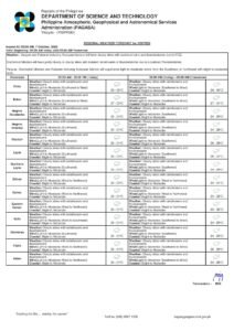
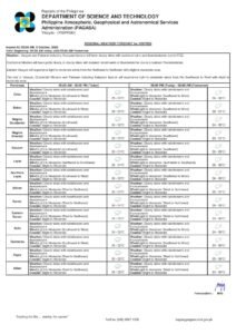
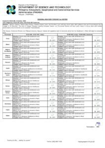
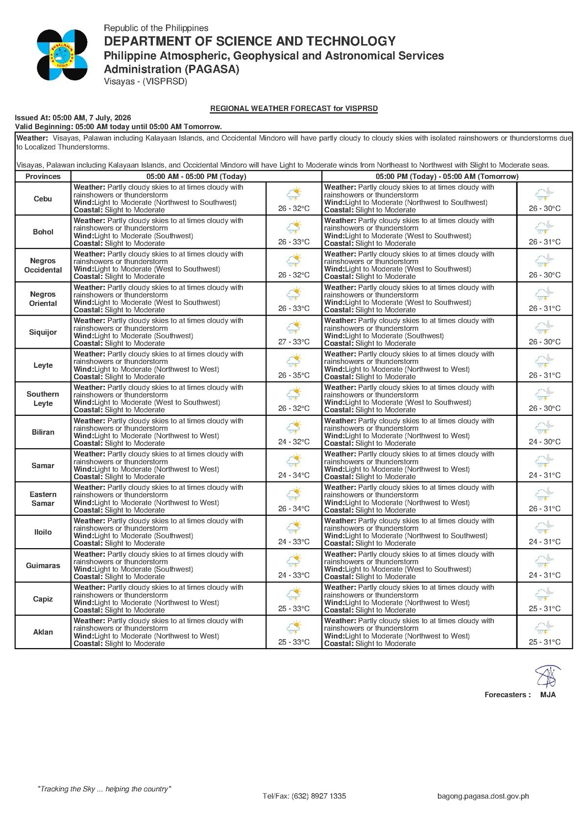
The Philippine Atmospheric, Geophysical and Astronomical Services Administration — commonly known as PAGASA — released its regional forecast for the Visayas at 5:00 AM on July 7, 2026, indicating partly cloudy to occasionally cloudy skies accompanied by rainshowers or thunderstorms. The same unsettled pattern is expected to carry over into Wednesday, July 8, according to PAGASA’s bulletin.
What Is Behind the Unsettled Weather?
PAGASA did not attribute today’s conditions to a named weather system such as a tropical cyclone, low-pressure area, or active monsoon front in this particular bulletin. However, the agency’s forecast describes wind flow from the northwest to southwest at light to moderate speeds — a pattern broadly consistent with transitional monsoon influence typical of mid-year conditions in the Philippines.
In practical terms, what PAGASA’s forecast describes is an atmosphere carrying sufficient moisture and instability to generate localized, often sudden bursts of rain and lightning at various points during the day. These are not sustained, continuous downpours — instead, they are the kind of showers that can develop quickly, intensify sharply, and then ease off before re-forming in another area a short time later. Residents should not be lulled into complacency during dry spells between showers.
Conditions Across Negros Oriental and Siquijor
PAGASA’s forecast covers two consecutive forecast periods — Tuesday, July 7, and Wednesday, July 8 — with both days carrying an identical weather outlook: partly cloudy to at times cloudy skies, with rainshowers or thunderstorms expected.
Across Negros Oriental, mornings in Dumaguete, Bais, Bayawan, and Guihulngan may begin with relatively clear or partly cloudy conditions before cloud cover builds through late morning and into the afternoon — the period when convective thunderstorms typically intensify. Siquijor island falls under the same PAGASA regional forecast and should anticipate comparable weather behavior.
PAGASA also confirmed that no tropical cyclone wind signals are in effect for Negros Oriental or any part of the Visayas under this bulletin. Today’s weather, while genuinely unsettled, does not carry the elevated threat level associated with a tropical storm or typhoon.
By the Numbers
- Forecast issued at 5:00 AM, July 7, 2026
- Temperature range for Tuesday and Wednesday: 26°C to 32°C
- Extended outlook covers 3 days (July 7–9)
- Monday forecast (July 7): temperatures 27°C–32°C, winds northwest to southwest, coastal condition slight to moderate
- Tuesday forecast (July 8): temperatures 26°C–32°C, winds west to southwest, coastal condition slight to moderate
- Wednesday forecast (July 9): temperatures 26°C–32°C, winds moderate from the southwest, coastal condition slight to moderate
- Extended outlook reference bulletin issued at 9:00 AM, July 6, 2026
Three-Day Weather Trend
PAGASA’s extended weather outlook — issued at 9:00 AM on July 6, 2026 — charts the regional picture through at least Wednesday, July 9. The agency’s data shows that unsettled conditions will persist through the middle of the week, with winds gradually shifting toward a more consistently southwesterly direction and becoming slightly stronger by Wednesday. Coastal conditions across all three days are rated as slight to moderate — workable for medium to large vessels, but requiring heightened vigilance from operators of small watercraft such as outrigger bancas.
The waters immediately surrounding Negros Oriental — including the Tañon Strait, the Bohol Sea, and the seas around Siquijor — fall within this coastal assessment. PAGASA advises small-boat operators to keep a close eye on rapidly developing cumulonimbus cloud formations, which signal incoming thunderstorm squalls capable of temporarily elevating wave heights and drastically reducing sea visibility.
Understanding the Forecast Terms
PAGASA’s use of specific terminology in its bulletin carries real meaning that residents should understand:
- Rainshowers indicate intermittent rain — it will come and go at unpredictable intervals rather than fall continuously throughout the day.
- Thunderstorms indicate that lightning is possible. PAGASA regards lightning as one of the most dangerous weather hazards in the Philippine setting, and its inclusion in the forecast is a genuine warning rather than a formality.
- Slight to moderate coastal conditions mean that wave heights are manageable for larger vessels but remain potentially hazardous for small wooden boats, especially during sudden squalls associated with passing thunderstorms.
The agency recommends that anyone caught outdoors during a thunderstorm seek sturdy indoor shelter immediately, avoid tall trees, open fields, metal structures, and bodies of water, and if at sea aboard a small vessel, return to port before lightning develops overhead.
Sector-by-Sector Guidance
Ferry Passengers and Inter-Island Travelers
Passengers booked on routes connecting Dumaguete to Siquijor, Dumaguete to Cebu, or other inter-island services operated by carriers such as OceanJet, Montenegro Lines, or local ro-ro operators should check with their respective shipping lines before heading to the pier. While PAGASA has not issued a gale warning and describes coastal conditions as slight to moderate, thunderstorm squalls can briefly spike wave heights and reduce visibility. Travelers are advised to verify vessel departure clearances on any day when thunderstorms appear in the forecast.
Fisherfolk and Small-Boat Operators
Coastal fishing communities along Bayawan, Bais, Zamboanguita, and waters around Siquijor face a day that demands extra caution, according to PAGASA’s advisory data. The combination of light to moderate winds, slight to moderate swells, and the real possibility of sudden thunderstorm development makes it advisable to fish closer to shore and to watch the skyline continuously. PAGASA’s standard guidance applies: when tall, dark anvil-shaped cumulonimbus clouds begin building rapidly on the horizon, do not wait — head back to port immediately.
Farmers
Agricultural communities in the sugarcane, rice, and vegetable-growing areas of Guihulngan, La Libertad, Tayasan, and surrounding lowlands stand to benefit from the expected soil moisture that today’s rainshowers can provide, potentially reducing irrigation needs. The caution, however, lies in the thunderstorm component — gusty winds accompanying squalls can lodge or physically damage standing crops. PAGASA’s bulletin supports advice to secure any lightweight farm equipment or materials susceptible to sudden strong winds.
Students, Parents, and Schools
With no typhoon wind signals in effect, there is no weather-triggered automatic basis for class suspensions under existing PAGASA protocols for Tuesday, July 7. However, local government units across Negros Oriental retain the authority to suspend classes based on actual on-the-ground conditions. The Local Disaster Risk Reduction and Management Offices (LDRRMOs) in each municipality remain the proper monitoring bodies for such announcements. Parents are encouraged not to allow children to walk through flooded streets or be caught in lightning-exposed open areas during thunderstorm episodes.
Outdoor Workers
Construction teams, utility workers, and others engaged in outdoor labor across Negros Oriental should build flexibility into their Tuesday schedules. PAGASA’s forecast of recurring rainshowers and potential thunderstorms throughout the day means conditions can shift quickly. Work at height — including scaffolding, roofing, or electrical installations — should be suspended whenever lightning or strong gusty winds are detected nearby, consistent with standard occupational safety practices.
Why This Matters
PAGASA’s forecast of rainshowers and thunderstorms across Negros Oriental and the Visayas on July 7–8, 2026 carries real safety implications for a broad cross-section of the population — from fisherfolk navigating coastal waters to farmers protecting standing crops and students traveling to school. While no tropical cyclone signals are in effect, the bureau’s explicit warning of possible lightning and intermittent heavy downpours means that failure to take precautions can result in injury, property damage, or loss of livelihood. The three-day extended outlook further confirms that unsettled conditions will persist through at least mid-week, requiring sustained community awareness and preparation rather than a single-day response.
Source: PAGASA / breakingnewsnegrosoriental.com