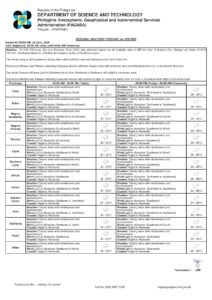
DUMAGUETE CITY, Negros Oriental — A weather system dominated by the southwest monsoon will bring persistent rain, cloud cover, and thunderstorms to Negros Oriental and the rest of the Visayas on Tuesday, June 30, 2026, according to a forecast released by the Philippine Atmospheric, Geophysical and Astronomical Services Administration (PAGASA) at 5:00 AM that same morning. The wet conditions are expected to affect daily life across the province — from morning commuters in Dumaguete to coastal communities in Bayawan and Guihulngan, as well as passengers on inter-island routes connecting Negros Oriental to Siquijor and Cebu.
By the Numbers
- Forecast temperature range for June 30: 26°C to 31°C
- Forecast temperature range for Wednesday, July 1: 25°C to 31°C
- Forecast temperature range for Monday (preceding day): 26°C to 32°C
- PAGASA extended outlook issued: 9:00 AM, June 29, 2026
- Morning forecast issued: 5:00 AM, June 30, 2026
- Coastal sea conditions rated: slight to moderate
The Monsoon Is the Driver
PAGASA identified the habagat, or southwest monsoon, as the primary force behind today’s weather. Winds are blowing from the southwest to south direction at light to moderate speeds — a hallmark of the monsoon season that typically holds sway over the Philippines from June through September. The habagat pushes warm, moisture-heavy air from the southwest across the archipelago; as this air mass rises over land and sea, it cools, condenses, and generates the sustained cloudiness, rainshowers, and embedded thunderstorms that PAGASA is now projecting for the Visayas region.
PAGASA further noted that this is not a brief, isolated weather event. The agency’s extended weather outlook indicates that the wet pattern will persist through at least the coming days, making it essential for residents to follow official forecasts closely throughout the week.
A Multi-Day Wet Pattern for the Region
The PAGASA extended outlook, issued at 9:00 AM on June 29, 2026, projects the following conditions for Negros Oriental and the broader Visayas:
- Monday (preceding day): 26°C–32°C, light to moderate southwest-to-northwest winds, slight to moderate coastal conditions.
- Tuesday, June 30 (today): 26°C–31°C, moderate southwest-to-south winds, moderate coastal conditions.
- Wednesday, July 1: 25°C–31°C, light to moderate southwest-to-south winds, slight to moderate coastal conditions.
- Thursday: 25°C–31°C — continued wet conditions expected based on available data.
The consistency of southwesterly winds and wet conditions across all forecast days signals that Negros Oriental is firmly in the grip of an active monsoon pattern, one that residents, workers, and businesses will need to plan around for the entire week, according to PAGASA’s projections.
Province-Wide Coverage
The PAGASA forecast applies to the entire Visayas region, which means every part of Negros Oriental falls within the affected zone. This includes the provincial capital Dumaguete in the south, the mid-province cities of Bais and Guihulngan, and Bayawan in the southwest. The island province of Siquijor — reachable by a short sea crossing from Dumaguete — is also under the same forecast umbrella of cloudy skies, rain, and thunderstorms, PAGASA confirmed.
Coastal waters around the region have been rated slight to moderate. PAGASA’s use of this classification means wave heights are present and non-trivial: the sea is not calm, and conditions are capable of affecting smaller watercraft such as outrigger bancas and fishing boats.
Understanding the Forecast Elements
Cloudy Skies With Rainshowers and Thunderstorms
When PAGASA issues a forecast of “cloudy skies with rainshowers and thunderstorms,” it means residents should expect more overcast and wet periods than dry ones, with the added risk of heavier downpours and lightning at any point during the day. Thunderstorms are particularly hazardous — they can develop rapidly and bring sudden gusty winds, intense short-duration rainfall, and dangerous lightning strikes. Localized flooding in low-lying areas and near drainage channels is possible during these storm bursts. PAGASA advises that anyone who hears thunder or spots lightning should move indoors immediately and remain away from open fields, tall trees, and bodies of water until the storm has fully passed.
Light to Moderate Southwesterly Winds
On land, light to moderate winds are noticeable but generally non-destructive. Out at sea, however, these same winds generate wave activity that makes navigation more challenging and potentially dangerous for lighter, smaller vessels — a key concern for fishing communities along Negros Oriental’s coastline, according to PAGASA’s assessment.
Slight to Moderate Coastal Conditions
PAGASA’s “slight to moderate” coastal rating is not a clearance for all boat types. Small bancas and fishing outriggers are susceptible to being pushed or destabilised by the prevailing wave conditions. Operators of these vessels should personally verify actual sea conditions at their departure point before launching, and should not interpret the rating as a guarantee of safe passage for all craft.
Sector-by-Sector Impact
Ferry Passengers and Inter-Island Travelers
Passengers planning to travel between Dumaguete and Siquijor, or from Negros Oriental to Cebu via ferry or fast craft services such as OceanJet, are advised to check with their shipping lines before proceeding to the port. PAGASA has not issued a gale warning for this forecast period, meaning conditions have not yet reached the threshold that automatically triggers suspension of sailings. Nevertheless, moderate coastal waters combined with the possibility of embedded thunderstorms can still prompt the Philippine Coast Guard or individual shipping operators to delay or cancel departures at their discretion. Travelers should arrive early, carry rain gear, and prepare an alternative plan should their sailing be postponed.
Fisherfolk and Small-Boat Operators
Fishing communities in Bayawan, Bais, and the coastal barangays of Negros Oriental face heightened risk today. The combination of southwesterly winds, moderate wave conditions, and the potential for sudden thunderstorms creates a hazardous environment for small open watercraft. PAGASA’s thunderstorm forecast carries a specific danger: storms can materialize quickly and produce sudden, powerful gusts without warning. Fisherfolk operating bancas are urged to monitor conditions continuously and, when in doubt, to remain ashore. No day’s catch is worth risking a life at sea.
Farmers and Agricultural Workers
For agricultural workers in the interior of Negros Oriental — including those managing sugarcane, corn, and vegetable plots in upland areas around Guihulngan and Canlaon — today’s sustained rainfall sends a mixed message. The moisture supports crops during the growing season, but waterlogged fields and slippery hillside terrain make fieldwork difficult and unsafe. Heavy rain from thunderstorms can also generate surface runoff capable of eroding topsoil and damaging young seedlings. PAGASA’s forecast advises avoiding outdoor fieldwork during active thunderstorm periods, and farmers should check drainage in low-lying plots before and after heavy rain events.
Students, Commuters, and School Families
Students and parents should plan for rain during both morning drop-off and afternoon dismissal hours. Extra travel time should be budgeted, particularly in flood-prone streets and low-lying barangays. If thunderstorms intensify, the safest approach is to wait indoors until the lightning and heavy rain have subsided before commuting. Parents are encouraged to monitor announcements from their local government units, as LGUs have the authority to declare class suspensions should conditions worsen significantly.
Outdoor Workers and Event Organizers
Construction workers, delivery personnel, market vendors, and others who work in open-air environments throughout Dumaguete and across Negros Oriental’s municipalities should gear up with appropriate rain protection and exercise heightened caution during periods of active lightning. Organizers of outdoor events scheduled for Tuesday are advised to prepare contingency plans or consider postponement given PAGASA’s forecast of thunderstorm activity throughout the day.
Why This Matters
The PAGASA forecast of cloudy skies, rainshowers, and thunderstorms across Negros Oriental and the Visayas on June 30, 2026, reflects a broad and sustained southwest monsoon pattern that is projected to continue through at least the end of the week. This multi-day wet season event carries real safety implications for coastal communities, fisherfolk operating small watercraft, outdoor workers, and inter-island travelers — all of whom face elevated risk from sudden thunderstorms and moderate sea conditions. The persistence of the habagat-driven weather, as confirmed by PAGASA’s extended outlook, means that preparedness measures cannot be limited to a single day but must be maintained across the entire week.
Source: Breaking News Negros Oriental (breakingnewsnegrosoriental.com)